
Texas Airports
|
West Texas Airport Map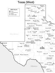 |
Northeast Texas Airport Map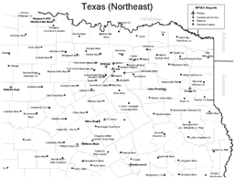 |
Texas Oil Rig Helipad |
South Texas Airport Map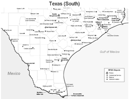 |
 The busiest airports in Texas are
the Bush Intercontinental Airport in Houston and
the Dallas/Fort Worth International Airport.
The busiest airports in Texas are
the Bush Intercontinental Airport in Houston and
the Dallas/Fort Worth International Airport.
Medium hub airports in Texas include the Austin-Bergstrom International Airport, the Dallas Love Field, the Hobby Airport in Houston, and the San Antonio International Airport.
Small hub airports in Texas include the Amarillo International Airport, the Corpus Christi International Airport, the El Paso International Airport, the Lubbock International Airport, the Midland International Airport, and the Valley International Airport in Harlingen.
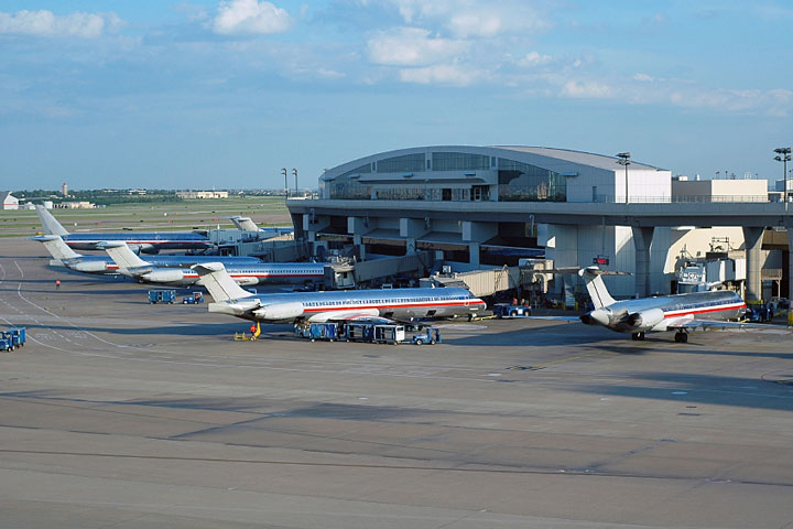
The photo at right shows aircraft parked at a Dallas-Fort Worth International Airport terminal.
Interactive Texas Airports Map
This section features an airport locator map that can be zoomed and panned to show the state of Texas and its neighbors or a small region of the state. Use the plus (+) and minus (-) buttons to zoom the map in and out, respectively. Simply swipe or drag the map to pan it in any direction. The airport markers on this Texas map can help travelers find IATA-designated airports in the state and plan their air travel arrangements more efficiently.Texas airport map source: FAA 2001-2005 NPIAS.