
Texas Relief Map
|
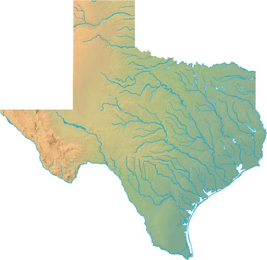
Static Texas Relief Map
Interactive Texas Relief Maps
The interactive relief map choices include a standard Google terrain map and an enhanced Google terrain map with Street View capabilities. To zoom in or out on either of these Texas maps, click or touch its plus (+) button or its minus (-) button, respectively. To pan either map in any direction, simply swipe it or drag it in that direction. To display either of these Texas terrain maps, click or touch one of the following menu options.
Texas' highest mountain is Guadalupe Peak, whose peak is 8,749 feet above sea level. The largest lake in Texas is Caddo Lake. If you are planning a visit to Texas, please see Texas Travel, the official state tourism site, where you can find a wide range of travel and vacation information. For information about Texas history and recreational activities, visit the following National Park sites.
Texas National Parks
- Alibates Flint Quarries National Monument
- Amistad National Recreation Area
- Big Bend National Park
- Big Thicket National Preserve
- Chamizal National Memorial
- El Camino Real de Tierra Adentro Historic Trail
- Fort Davis National Historic Site
- Guadalupe Mountains National Park
- Lake Meredith National Recreation Area
- Lyndon B Johnson National Historical Park
- Padre Island National Seashore
- Palo Alto Battlefield National Historic Site
- Rio Grande Wild & Scenic River
- San Antonio Missions National Historical Park
Copyright © 2005-2024 State-Maps.org. All rights reserved.
Texas-Map.org is a State Maps reference source.
To facilitate browsing, certain external links will open in new windows.
Texas-Map.org is a State Maps reference source.
To facilitate browsing, certain external links will open in new windows.